Detail
Tangggal iklan:
Kota: Jakarta Pusat
Kondisi: Baru
Penjual

Nama: Euro Teknologi
Terdaftar sejak: 10 Juli 2014
Status:

Facebook: Marketing.Eurotech
No Telpon: 0213-XXXX-XXXX
No Handphone: 0812-XXXX-XXXX
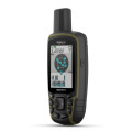
GPS Mapping Powerhouse with Android™ OS
4" dual orientation, sunlight-readable, durable mineral glass display with multi-touch interface
Get Android apps on Google Play™
8 megapixel autofocus camera and 1080p HD video with automatic geotagging, LED flash/torch
High-sensitivity GPS/GLONASS receiver for better positioning
3D MapMerge™ for multiple maps in 3-D
3D MapMerge
Monterra is the ultimate mapping tool with custom 3-D mapping. Combine 2 maps, for example TOPO and BirdsEye Satellite Imagery, then view both maps in 3-D. You’ll see rich textures, such as hills, valleys, lakes and forests. Zoom in, pan out and rotate the 3-D map using multi-touch.
Physical & Performance:
Unit dimensions, WxHxD 2.9" x 5.9" x 1.4" (7.48 x 14.96 x 3.63 cm)
Display size, WxH 2"W x 3.5"H (5.06 x 8.93 cm); 4" diag (10.2 cm)
Display resolution, WxH 272 x 480 pixels
Display type bright, transflective 65k color TFT, dual-orientation touchscreen; sunlight readable
Weight 11.7 oz (331 g) with included lithium-ion battery pack; 13.2 oz (375 g) with 3 AA batteries (not included)
Battery rechargeable lithium-ion (included) or 3 AA batteries (not included); NiMH or Lithium recommended
Battery life up to 16 hours (lithium-ion); up to 22 hours (AA batteries)
Waterproof Yes (IPX7)
Floats No
High-sensitivity receiver Yes
Interface High-speed USB
Maps & Memory:
Basemap Yes
Preloaded maps yes (topographic), some models
Ability to add maps Yes
Built-in memory 6 GB (With Worldwide Basemap); 3 GB (With TOPO U.S. 100K Maps)
Accepts data cards microSD™ card (not included)
Waypoints/favorites/locations 4000
Routes 200
Track log 10,000 points, 200 saved tracks
Features & Benefits:
Automatic routing (turn by turn routing on roads) Yes (with optional mapping for detailed roads)
Electronic compass Yes (tilt-compensated 3-axis)
Touchscreen Yes
Barometric altimeter Yes
Camera yes (8 megapixel with autofocus and 1080p/30fps video; LED flash; automatic geo-tagging)
Geocaching-friendly Yes (Paperless)
Custom maps compatible Yes
Photo navigation (navigate to geotagged photos) Yes
Hunt/fish calendar No
Sun and moon information No
Tide tables No
Area calculation Yes
Custom POIs (ability to add additional points of interest) Yes
Unit-to-unit transfer (shares data wirelessly with similar units) Yes
Picture viewer Yes
Garmin Connect™ compatible (online community where you analyze, categorize and share data) Yes
Additional
Bluetooth® wireless technology: yes
Wi-Fi connectivity: yes
ANT+™ connectivity: yes
GNSS support: yes (GPS + GLONASS)
Near Field Communication (NFC): yes
Microphone: yes (internal for audio capture)
Multimedia (audio/video) support: yes (MP3 player, video player, etc.)
UV sensor: yes
Android with Google Play for complete customization
In the box :
Monterra
Lithium-ion battery pack
USB cable
AC adapter
Anti-glare screen protectors
Memory 2GB + Map Indonesia
Documentation
1 Year warranty
PT EURO TEKNOLOGI - Pusat Perlengkapan Peralatan Komunikasi dan Navigasi Terlengkap dan Berkualitas di Indonesia.
Our Product & Service Category :
- Manine Navigation & Communication Equipment
- Mining & Plantation Equipment
- Satellite Communication
- Measuring & Survey Equipment
- Radio Communication
- GPS Mapping & Navigation
- Service & Design Electronics
UNTUK INFO LEBIH LANJUT DAN MENDAPATKAN PENAWARAN DENGAN HARGA TERBAIK , CONTACT US :
PT EURO TEKNOLOGI
Gedung Wisma Abadi Lt.4 No.B5
Jl. Kyai Caringin No.29-31
JAKARTA PUSAT - 10106
Hub : 021 - 3483 0867 / 3890 0408
Fax : 021 - 3483 0868
GSM : 0813 1118 5580
CDMA: 021 - 4911 1180 / 6868 8877
Note :
*Harga dan Stock Tidak Mengikat,Harga dapat berubah sewaktu-waktu, Konfirmasi via Telpon/SMS/E-mail Sebelum Pengambilan.

Fish Finder Koden CVS-126 Harga Dealer
Rp 12.000.000

Furuno GP-32 GPS / WAAS Navigator
Rp 4.200.000

Radar Furuno 1715 Harga Termurah
Rp 25.000.000

Radar Furuno 1623 Harga Termurah
Rp 20.000.000

Garmin Etrex 30 GPS Base Map Harga Termurah Jakarta
Rp 2.800.000
 English