Detail
Tangggal iklan:
Kota: Tangerang
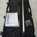
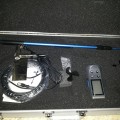
Merk: Garmin
Tipe: Aera 500
Kondisi: Baru
Penjual
Nama: Prima Akrindo
Terdaftar sejak: 13 September 2016
Status:

No Telpon: 0878-XXXX-XXXX
No Handphone: 0812-XXXX-XXXX
PRIMA AKRINDO
Jl.Chairil Anwar No.46
Kereo-Larangan
Tangerang-Banten 15156
Telp/Contac Person
Muhammad Arip
081294376475
087884008158
088210149196
email:
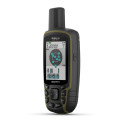
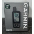
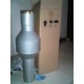
Garmin Aera 500 adalah GPS Garmin yang memiliki fitur penggunaan dual mode, untuk Aviasi dan Otomotif (penerbangan).Garmin Aera 500 memiliki database navigasi udara (Jeppesen) yang berisi lokasi-lokasi bandar udara wilayah Pacific beserta frekuensi radio bandaranya dan data terrain (ketinggian tanah). Dengan Interface layar sentuh, memudahkan pemakaian ketika di mobil ataupun pesawat.Garmin Aera 500 penting untuk dimiliki oleh para pilot dan penggiat olah raga dirgantara .
Spesifikasi
– Battery : removable, rechargeable lithium-ion
– Battery life : up to 5 hours (less with full backlight and options)
– Water rating : IPX7
– SBAS/WAAS receiver : high-sensitivity with WAAS position accuracy
– Voltage range : 11-35
– IFR or VFR : VFR
– Traffic Information Services (TIS) alerts compatible
– Basemap
– Preloaded street maps
– Ability to add maps
– Built-in memory : internal solid state
– Accepts data cards : yes (microSD™ cards)
– Custom POIs (ability to add additional points of interest) : Yes (Auto mode)
– Waypoints/favorites/locations : 3,000 (aviation mode),1,000 (automotive mode)
– Routes : 50
– Navigation database (includes Jeppesen® data)
– Navigation database coverage areas : Americas or Atlantic or Pacific
– Preloaded Terrain database
– Preloaded Obstacle database : Yes (U.S. and Europe only)
– Preloaded low & high altitude enroute airways
– Preloaded private airports : Yes (U.S. only)
– Speaks street names (e.g. “Turn right ON ELM STREET in 500 ft.”) : Yes (Auto mode)
– Bluetooth® wireless technology : yes (auto mode)
– Aviation Portable Features
– Moving map
– Patented panel page
– HSI (GPS-based)
– IFR map mode
– Audible terrain alerts
– Terrain resolution : standard
– Smart Airspace Feature (generates and displays altitude-sensitive alerts)
– Automatic logbook
– Separate serial and USB interfaces
– 3-D map view : Yes (Auto mode)
– GPS receiver has a nominal operating velocity range of 0 – 800 kts (411 m/s)
– Display size, WxH : 3.81″W x 2.25″H (9.7 x 5.7 cm); 4.3″ diag (10.9 cm)
– Display resolution, WxH : 480 x 272 pixels
– Display type : touchscreen WQVGA color TFT with white backlight
– Physical dimensions : 5.3″W x 3.3″H x .9″D (13.5 x 8.4 x 2.3 cm)
– Weight : 9.5 ounces (270 g)
Kami jual product lain seperti:
GPS GARMIN, GPS TRIMBLE, GPS FURUNO, GPS MAGELLAN
TOTAL STATION (SOKKIA,TOPCON,NIKON,SOUTH,RUIDE)
DIGITAL THEODOLITE (SOKKIA,TOPCON,NIKON,SOUTH,RUIDE)
AUTOMATIC LEVEL (SOKKIA,TOPCON,NIKON,SOUTH,RUIDE)
LEICA DISTO (D210,X310,D510,D810), GLOBAL WATER FLOW PROBE FP-111
DAVIS VANTAGA PRO 2 ,SOIL TASTER (ALAT UKUR KELEMBABPAN TANAH)
CURRENT METER FLOFATCH FL-03 (ALAT UKUR AIR DAN ANGIN)
KOMPAS SUUNTO (KB20,MC2 GLOBAL,KB14,CLINOMETER,TANDEM)
KOMPAS BRUNTON (5008,5006,5010), PALU GEOLOGI (RUNCING, PIPIH)
LOUPER, HANDY TALKY (HT MOTOROLA, ALINCO, YEUSU, VEV ), LOUPER
HAMMER TEST (ALAT UJI BETON) , PITA SURVEY WARNA ,PEN MAGNETIK
PERAHU KARET (ZEBEC, AVON, ACISSA),ABNAY LEVEL , RAIT IN THE RAIN
BINOCULAR/TEROPNG, OMBROMETER TABUNG CURAH HUJAN GALPANIS
ALMUNIUM TRIPOD, RAMBU UKUR (3M,5M,7M), PRISMA PHOLE
SAMPLE BAG.SOLINTS WATER LEVEL METER 101, TAJIMA SLANT 100
SPEED GUN BHUSNEL, PENAKAR CURAH HUJAN HILLMAN ,NIKON FORESTRY PRO
PENAKAR HUJAN NETA/NYLEX 1000, SANFIX, HAGA ALTIMETER, TELEPON SATELITE
MEASURING WHEEL (METERAN DORONG CLL 200, CLL 300, CLL 400, TOGOSHI)
DIGITAL PLANIMETR PLACOM KP N90, GEOPACK WATER ADVANCE (ALAT UKUR AIR)
 English